
West Des Moines topographic map
Interactive map
Click on the map to display elevation.
About this map
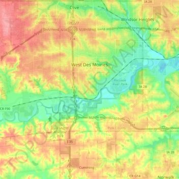
Name: West Des Moines topographic map, elevation, terrain.
Location: West Des Moines, Polk County, Iowa, United States (41.48927 -93.88687 41.60046 -93.69826)
Average elevation: 919 ft
Minimum elevation: 781 ft
Maximum elevation: 1,070 ft
Polk County trails, hiking, mountain biking, running and outdoor activities
Other topographic maps
Click on a map to view its topography, its elevation and its terrain.