
Arkabutla Lake topographic map
Interactive map
Click on the map to display elevation.
About this map
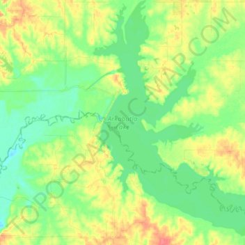
Name: Arkabutla Lake topographic map, elevation, terrain.
Location: Arkabutla Lake, Tate County, Mississippi, United States (34.69536 -90.13189 34.81718 -90.00585)
Average elevation: 236 ft
Minimum elevation: 167 ft
Maximum elevation: 348 ft
Mississippi trails, hiking, mountain biking, running and outdoor activities