
Điện Biên Phủ topographic map
Interactive map
Click on the map to display elevation.
About this map
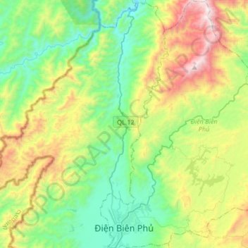
Name: Điện Biên Phủ topographic map, elevation, terrain.
Location: Điện Biên Phủ, Điện Biên Province, Vietnam (21.36646 102.99298 21.61489 103.18684)
Average elevation: 2,930 ft
Minimum elevation: 1,240 ft
Maximum elevation: 6,568 ft
Other topographic maps
Click on a map to view its topography, its elevation and its terrain.
Bản Mường Nhé
Vietnam > Điện Biên Province > Mường Nhé District > Muong Nhe
Average elevation: 1,929 ft