
Brownville topographic map
Interactive map
Click on the map to display elevation.
About this map
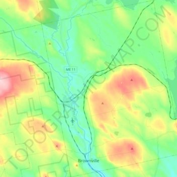
Name: Brownville topographic map, elevation, terrain.
Location: Brownville, Piscataquis County, Maine, 04414, United States (45.29545 -69.08237 45.42310 -68.93808)
Average elevation: 525 ft
Minimum elevation: 312 ft
Maximum elevation: 935 ft
Piscataquis County trails, hiking, mountain biking, running and outdoor activities
Other topographic maps
Click on a map to view its topography, its elevation and its terrain.
Mount Katahdin
United States > Maine > Piscataquis County > Mount Katahdin Township
It is commonly thought that Katahdin is the first place in the United States mainland to receive sunlight in the morning, but this is incorrect. Other mountains lower in elevation but farther to the east or southeast see the first sunrise of the day, depending on the season. Regardless, the summit of Katahdin…
Average elevation: 3,990 ft