
New Jersey topographic map
Interactive map
Click on the map to display elevation.
About this map
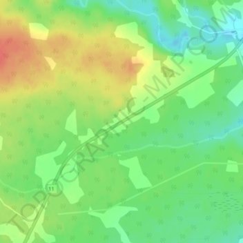
Name: New Jersey topographic map, elevation, terrain.
Average elevation: 79 ft
Minimum elevation: 3 ft
Maximum elevation: 161 ft
Other topographic maps
Click on a map to view its topography, its elevation and its terrain.
Tabusintac River
Canada > New Brunswick > Northumberland County
Tabusintac River, Northumberland County, New Brunswick, Canada
Average elevation: 3 ft
Miramichi
Canada > New Brunswick > Northumberland County > Miramichi
Miramichi, City of Miramichi, Northumberland County, New Brunswick, Canada
Average elevation: 151 ft
McNamee
Canada > New Brunswick > Northumberland County
McNamee, Ludlow Parish, Northumberland County, New Brunswick, Canada
Average elevation: 338 ft