
Kanarraville topographic map
Interactive map
Click on the map to display elevation.
About this map
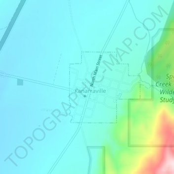
Name: Kanarraville topographic map, elevation, terrain.
Location: Kanarraville, Iron County, Utah, 84742, United States (37.53236 -113.18705 37.54340 -113.17311)
Average elevation: 5,646 ft
Minimum elevation: 5,440 ft
Maximum elevation: 6,752 ft
Iron County trails, hiking, mountain biking, running and outdoor activities
Other topographic maps
Click on a map to view its topography, its elevation and its terrain.