
Make a donation
Gear up for your next adventure:
As an Amazon Associate, this site earns from qualifying purchases at no extra cost to you.
Kettle Moraine State Forest- Lapham Peak Unit topographic map
Click on the map to display elevation.
Make a donation
Gear up for your next adventure:
As an Amazon Associate, this site earns from qualifying purchases at no extra cost to you.
Kettle Moraine State Forest- Lapham Peak Unit
The park takes its name from a hill found within its borders. Lapham Peak has an elevation of 1,233 feet (376 m) above sea level, and is the highest point in Waukesha County. At the top of Lapham Peak is a wooden observation tower that is 45 feet (14 m) high and offers a dynamic view of southeastern Wisconsin and the northern edge of Illinois. The Waukesha County Historical Society named the peak in memory of Increase A. Lapham to honor his efforts in scientific study and his founding of the United States Weather Bureau.
Make a donation
Gear up for your next adventure:
As an Amazon Associate, this site earns from qualifying purchases at no extra cost to you.
About this map
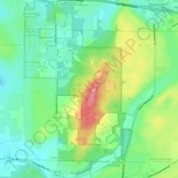
Name: Kettle Moraine State Forest- Lapham Peak Unit topographic map, elevation, terrain.
Average elevation: 1,004 ft
Minimum elevation: 889 ft
Maximum elevation: 1,214 ft
Wisconsin trails, hiking, mountain biking, running and outdoor activities
Make a donation
Gear up for your next adventure:
As an Amazon Associate, this site earns from qualifying purchases at no extra cost to you.