
Alton topographic map
Interactive map
Click on the map to display elevation.
About this map
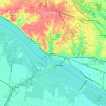
Name: Alton topographic map, elevation, terrain.
Location: Alton, Madison County, Illinois, 62002, United States (38.85086 -90.22431 38.93086 -90.14431)
Average elevation: 482 ft
Minimum elevation: 394 ft
Maximum elevation: 659 ft
Madison County trails, hiking, mountain biking, running and outdoor activities