
South Lake Tahoe topographic map
Interactive map
Click on the map to display elevation.
About this map
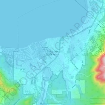
Name: South Lake Tahoe topographic map, elevation, terrain.
Average elevation: 6,378 ft
Minimum elevation: 6,224 ft
Maximum elevation: 8,173 ft
El Dorado County trails, hiking, mountain biking, running and outdoor activities