
Thank you for supporting this site ❤️
Make a donation
Make a donation
Gear up for your next adventure:
As an Amazon Associate, this site earns from qualifying purchases at no extra cost to you.
Son Duong topographic map
Click on the map to display elevation.
Thank you for supporting this site ❤️
Make a donation
Make a donation
Gear up for your next adventure:
As an Amazon Associate, this site earns from qualifying purchases at no extra cost to you.
About this map
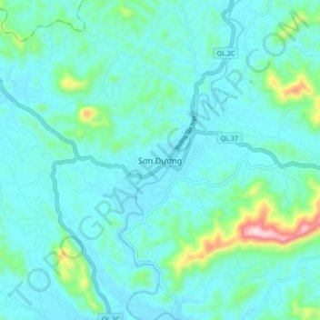
Name: Son Duong topographic map, elevation, terrain.
Location: Son Duong, Son Duong District, Tuyen Quang Province, Vietnam (21.65846 105.35186 21.73846 105.43186)
Average elevation: 361 ft
Minimum elevation: 164 ft
Maximum elevation: 1,463 ft
Thank you for supporting this site ❤️
Make a donation
Make a donation
Gear up for your next adventure:
As an Amazon Associate, this site earns from qualifying purchases at no extra cost to you.