
Linglestown topographic map
Interactive map
Click on the map to display elevation.
Linglestown
The highest elevation is 995 feet (303 m) on the south slope of Blue Mountain, along Blue Mountain Parkway north of the center of town. Pennsylvania Route 39 (Linglestown Road) passes east-to-west through the village, leading east 3.5 miles (5.6 km) to Exit 77 on Interstate 81 and west 5 miles (8 km) to Highway 22-322 at the north end of Harrisburg.
About this map
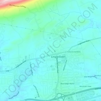
Name: Linglestown topographic map, elevation, terrain.
Average elevation: 528 ft
Minimum elevation: 407 ft
Maximum elevation: 1,234 ft
Dauphin County trails, hiking, mountain biking, running and outdoor activities