
Waverly topographic map
Interactive map
Click on the map to display elevation.
About this map
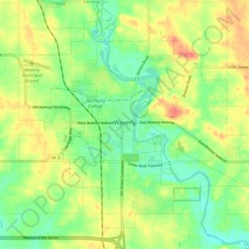
Name: Waverly topographic map, elevation, terrain.
Location: Waverly, Bremer County, Iowa, 50677, United States (42.69653 -92.51483 42.75380 -92.42085)
Average elevation: 961 ft
Minimum elevation: 879 ft
Maximum elevation: 1,060 ft
Bremer County trails, hiking, mountain biking, running and outdoor activities