
Cherryville topographic map
Interactive map
Click on the map to display elevation.
About this map
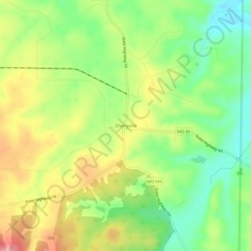
Name: Cherryville topographic map, elevation, terrain.
Location: Cherryville, Crawford County, Missouri, 65446, United States (37.83199 -91.29681 37.87199 -91.25681)
Average elevation: 988 ft
Minimum elevation: 807 ft
Maximum elevation: 1,204 ft
Missouri trails, hiking, mountain biking, running and outdoor activities