
Beulah topographic map
Interactive map
Click on the map to display elevation.
About this map
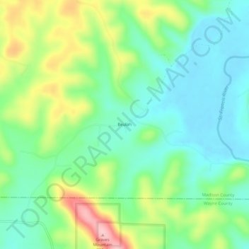
Name: Beulah topographic map, elevation, terrain.
Location: Beulah, Madison County, Missouri, 63636, United States (37.30894 -90.52234 37.34894 -90.48234)
Average elevation: 630 ft
Minimum elevation: 446 ft
Maximum elevation: 1,004 ft
Missouri trails, hiking, mountain biking, running and outdoor activities