
Thank you for supporting this site ❤️
Make a donation
Make a donation
Gear up for your next adventure:
As an Amazon Associate, this site earns from qualifying purchases at no extra cost to you.
Phú Quốc topographic map
Click on the map to display elevation.
Thank you for supporting this site ❤️
Make a donation
Make a donation
Gear up for your next adventure:
As an Amazon Associate, this site earns from qualifying purchases at no extra cost to you.
About this map
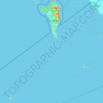
Name: Phú Quốc topographic map, elevation, terrain.
Location: Phú Quốc, Đặc khu Thổ Châu, An Giang Province, Vietnam (9.25430 103.45043 10.45260 104.09849)
Average elevation: 10 ft
Minimum elevation: -3 ft
Maximum elevation: 1,745 ft
Thank you for supporting this site ❤️
Make a donation
Make a donation
Gear up for your next adventure:
As an Amazon Associate, this site earns from qualifying purchases at no extra cost to you.