
Jay Township topographic map
Interactive map
Click on the map to display elevation.
About this map
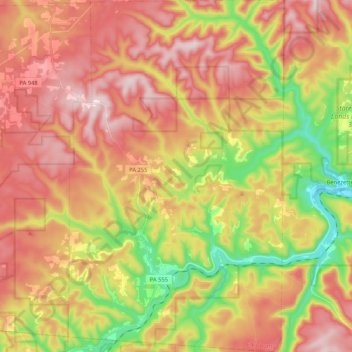
Name: Jay Township topographic map, elevation, terrain.
Location: Jay Township, Elk County, Pennsylvania, United States (41.24052 -78.54884 41.39801 -78.42000)
Average elevation: 1,706 ft
Minimum elevation: 988 ft
Maximum elevation: 2,313 ft
Elk County trails, hiking, mountain biking, running and outdoor activities
Other topographic maps
Click on a map to view its topography, its elevation and its terrain.