
West Coast topographic map
Interactive map
Click on the map to display elevation.
About this map
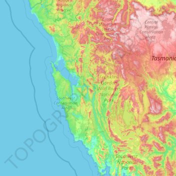
Name: West Coast topographic map, elevation, terrain.
Location: West Coast, Tasmania, Australia (-43.32262 144.90964 -41.58229 146.13431)
Average elevation: 1,060 ft
Minimum elevation: -3 ft
Maximum elevation: 4,908 ft
Other topographic maps
Click on a map to view its topography, its elevation and its terrain.