
Liberty Township topographic map
Interactive map
Click on the map to display elevation.
About this map
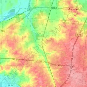
Name: Liberty Township topographic map, elevation, terrain.
Location: Liberty Township, Butler County, Ohio, United States (39.36810 -84.47862 39.43368 -84.34141)
Average elevation: 768 ft
Minimum elevation: 594 ft
Maximum elevation: 912 ft
Butler County trails, hiking, mountain biking, running and outdoor activities
Other topographic maps
Click on a map to view its topography, its elevation and its terrain.