
Clark Canyon Creek topographic map
Interactive map
Click on the map to display elevation.
About this map
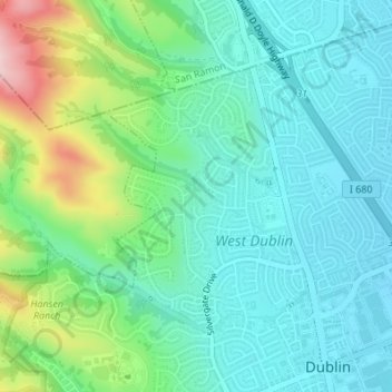
Name: Clark Canyon Creek topographic map, elevation, terrain.
Average elevation: 558 ft
Minimum elevation: 331 ft
Maximum elevation: 1,230 ft
Alameda County trails, hiking, mountain biking, running and outdoor activities
Other topographic maps
Click on a map to view its topography, its elevation and its terrain.
Dougherty Hills Open Space
United States > California > Alameda County > Dublin > Komandorski Village
Average elevation: 394 ft