Geolocate

Heer-Agimont topographic map

Click on the map to display elevation.

About this map

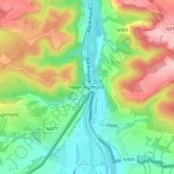
Name: Heer-Agimont topographic map, elevation, terrain.

Location: Heer-Agimont, Hastière, Dinant, Namen, Wallonië, 5543, België (50.15050 4.80266 50.19050 4.84266)

Average elevation: 548 ft

Minimum elevation: 305 ft

Maximum elevation: 932 ft

Gear up for your next adventure:

🎁Geography Themed Gifts - Unique gift ideas for map lovers and geography enthusiasts
🌐World Map Poster - Decorative world maps with topographic info
🔦Powerful Headlamps - Ultra-bright hands-free lighting for night navigation
👟Trail Running Shoes - Lightweight shoes for trail runners
Solar GPS Watches - Advanced multisport watches with built-in topographic maps

As an Amazon Associate, this site earns from qualifying purchases at no extra cost to you.