
Kamas topographic map
Interactive map
Click on the map to display elevation.
About this map
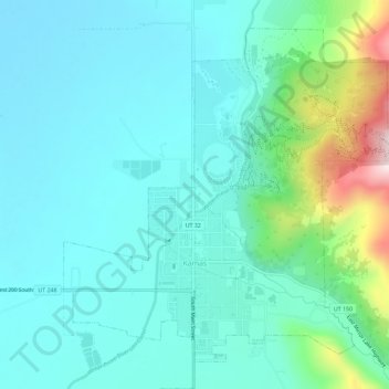
Name: Kamas topographic map, elevation, terrain.
Location: Kamas, Summit County, Utah, 84036, United States (40.63189 -111.29996 40.66935 -111.24237)
Average elevation: 6,608 ft
Minimum elevation: 6,312 ft
Maximum elevation: 7,861 ft
Summit County trails, hiking, mountain biking, running and outdoor activities
Other topographic maps
Click on a map to view its topography, its elevation and its terrain.