Geolocate

New Hampton topographic map

Interactive map

Click on the map to display elevation.

About this map

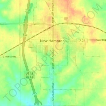
Name: New Hampton topographic map, elevation, terrain.

Location: New Hampton, Chickasaw County, Iowa, 50659, United States (43.03017 -92.33783 43.07764 -92.28884)

Average elevation: 1,145 ft

Minimum elevation: 1,083 ft

Maximum elevation: 1,198 ft

Other topographic maps

Click on a map to view its topography, its elevation and its terrain.

Fredericksburg

United States > Iowa > Chickasaw County

Fredericksburg, Chickasaw County, Iowa, United States

Average elevation: 1,093 ft

Alta Vista

United States > Iowa > Chickasaw County

Alta Vista, Chickasaw County, Iowa, United States

Average elevation: 1,181 ft

Ionia

United States > Iowa > Chickasaw County

Ionia, Chickasaw County, Iowa, United States

Average elevation: 1,132 ft

Lawler

United States > Iowa > Chickasaw County

Lawler, Chickasaw County, Iowa, United States

Average elevation: 1,109 ft

North Washington

United States > Iowa > Chickasaw County

North Washington, Chickasaw County, Iowa, 50661, United States

Average elevation: 1,129 ft

Nashua

United States > Iowa > Chickasaw County

Nashua, Chickasaw County, Iowa, United States

Average elevation: 991 ft

Bassett

United States > Iowa > Chickasaw County

Bassett, Chickasaw County, Iowa, United States

Average elevation: 1,050 ft