
Hygiene topographic map
Interactive map
Click on the map to display elevation.
About this map
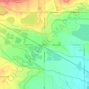
Name: Hygiene topographic map, elevation, terrain.
Location: Hygiene, Boulder County, Colorado, 80533, United States (40.16878 -105.19806 40.20878 -105.15806)
Average elevation: 5,112 ft
Minimum elevation: 5,013 ft
Maximum elevation: 5,249 ft