
Thank you for supporting this site ❤️
Make a donation
Make a donation
Gear up for your next adventure:
As an Amazon Associate, this site earns from qualifying purchases at no extra cost to you.
Hygiene topographic map
Click on the map to display elevation.
Thank you for supporting this site ❤️
Make a donation
Make a donation
Gear up for your next adventure:
As an Amazon Associate, this site earns from qualifying purchases at no extra cost to you.
About this map
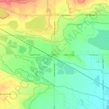
Name: Hygiene topographic map, elevation, terrain.
Location: Hygiene, Boulder County, Colorado, 80533, United States (40.16878 -105.19806 40.20878 -105.15806)
Average elevation: 5,112 ft
Minimum elevation: 5,013 ft
Maximum elevation: 5,249 ft
Colorado trails, hiking, mountain biking, running and outdoor activities
Thank you for supporting this site ❤️
Make a donation
Make a donation
Gear up for your next adventure:
As an Amazon Associate, this site earns from qualifying purchases at no extra cost to you.