
Unicoi topographic map
Interactive map
Click on the map to display elevation.
About this map
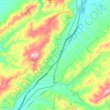
Name: Unicoi topographic map, elevation, terrain.
Location: Unicoi, Unicoi County, Tennessee, United States (36.17473 -82.38196 36.26061 -82.26989)
Average elevation: 2,326 ft
Minimum elevation: 1,654 ft
Maximum elevation: 3,458 ft
Unicoi County trails, hiking, mountain biking, running and outdoor activities
Other topographic maps
Click on a map to view its topography, its elevation and its terrain.
Pleasant Garden
United States > Tennessee > Unicoi County > Pleasant Garden
Average elevation: 3,921 ft