
Grand Mound topographic map
Click on the map to display elevation.
About this map
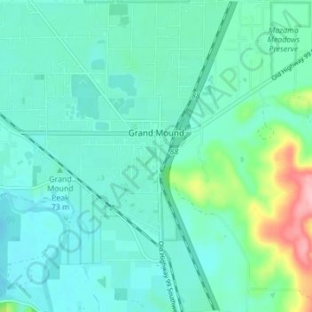
Name: Grand Mound topographic map, elevation, terrain.
Location: Grand Mound, Thurston County, Washington, United States (46.77545 -123.03706 46.82253 -122.98886)
Average elevation: 200 ft
Minimum elevation: 112 ft
Maximum elevation: 587 ft
Thurston County trails, hiking, mountain biking, running and outdoor activities
Other topographic maps
Click on a map to view its topography, its elevation and its terrain.
Centralia Coal Mine Dam No 32B
United States > Washington > Thurston County > Tono
Average elevation: 341 ft