
Zell am Main topographic map
Interactive map
Click on the map to display elevation.
About this map
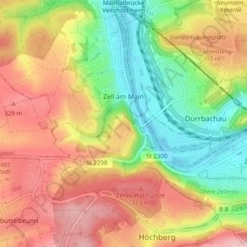
Name: Zell am Main topographic map, elevation, terrain.
Location: Zell am Main, Landkreis Würzburg, Bavaria, 97299, Germany (49.78199 9.82617 49.82646 9.88348)
Average elevation: 856 ft
Minimum elevation: 545 ft
Maximum elevation: 1,168 ft