
Chimanimani topographic map
Interactive map
Click on the map to display elevation.
About this map
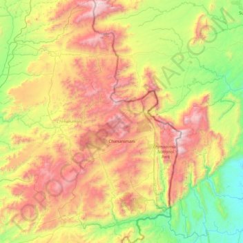
Name: Chimanimani topographic map, elevation, terrain.
Location: Chimanimani, Manicaland, Zimbabwe (-20.13020 32.34534 -19.37496 33.06281)
Average elevation: 3,373 ft
Minimum elevation: 722 ft
Maximum elevation: 7,904 ft
Other topographic maps
Click on a map to view its topography, its elevation and its terrain.
Mount Nyangani
Mount Nyangani, Nyanga, Manicaland, Zimbabwe
Average elevation: 7,641 ft