
Nantucket topographic map
Interactive map
Click on the map to display elevation.
About this map
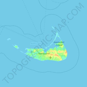
Name: Nantucket topographic map, elevation, terrain.
Location: Nantucket, Nantucket County, Massachusetts, United States (41.18886 -70.39736 41.44339 -69.89364)
Average elevation: 3 ft
Minimum elevation: -20 ft
Maximum elevation: 89 ft
Nantucket County trails, hiking, mountain biking, running and outdoor activities