
Shijingshan District topographic map
Interactive map
Click on the map to display elevation.
About this map
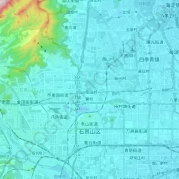
Name: Shijingshan District topographic map, elevation, terrain.
Location: Shijingshan District, PRC (39.87252 116.10580 39.99230 116.25345)
Average elevation: 318 ft
Minimum elevation: 131 ft
Maximum elevation: 2,598 ft
Other topographic maps
Click on a map to view its topography, its elevation and its terrain.