
Stoumont topographic map
Interactive map
Click on the map to display elevation.
About this map
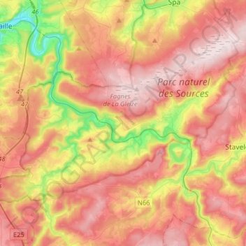
Name: Stoumont topographic map, elevation, terrain.
Location: Stoumont, Verviers, Liège, Wallonia, 4987, Belgium (50.35625 5.67016 50.46411 5.93091)
Average elevation: 1,250 ft
Minimum elevation: 390 ft
Maximum elevation: 1,903 ft
Other topographic maps
Click on a map to view its topography, its elevation and its terrain.