
Throckmorton topographic map
Interactive map
Click on the map to display elevation.
About this map
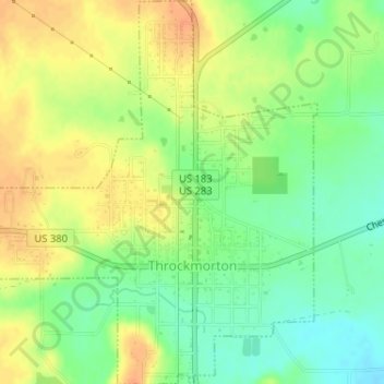
Name: Throckmorton topographic map, elevation, terrain.
Average elevation: 1,339 ft
Minimum elevation: 1,276 ft
Maximum elevation: 1,394 ft
Other topographic maps
Click on a map to view its topography, its elevation and its terrain.
Elbert
United States > Texas > Throckmorton County
Elbert, Throckmorton County, Texas, United States
Average elevation: 1,168 ft