
McMinnville topographic map
Interactive map
Click on the map to display elevation.
About this map
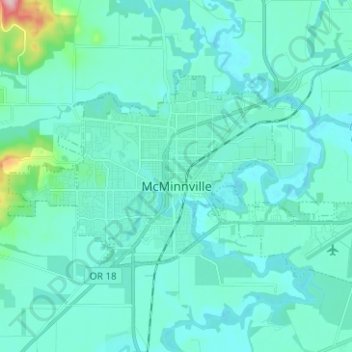
Name: McMinnville topographic map, elevation, terrain.
Location: McMinnville, Yamhill County, Oregon, 97128, United States (45.18573 -123.25450 45.23922 -123.12920)
Average elevation: 164 ft
Minimum elevation: 82 ft
Maximum elevation: 833 ft
Yamhill County trails, hiking, mountain biking, running and outdoor activities
Other topographic maps
Click on a map to view its topography, its elevation and its terrain.