
La Pine topographic map
Interactive map
Click on the map to display elevation.
About this map
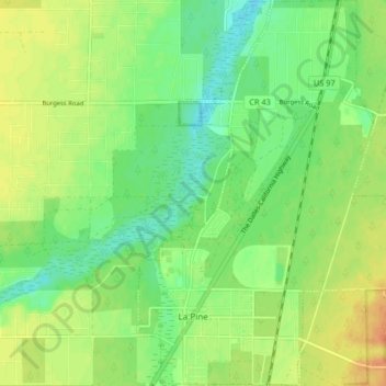
Name: La Pine topographic map, elevation, terrain.
Location: La Pine, Deschutes County, Oregon, 97739, United States (43.65968 -121.51545 43.71924 -121.45266)
Average elevation: 4,232 ft
Minimum elevation: 4,180 ft
Maximum elevation: 4,291 ft
Deschutes County trails, hiking, mountain biking, running and outdoor activities
Other topographic maps
Click on a map to view its topography, its elevation and its terrain.
Three Sisters
United States > Oregon > Deschutes County
The Three Sisters are closely spaced volcanic peaks in the U.S. state of Oregon. They are part of the Cascade Volcanic Arc, a segment of the Cascade Range in western North America extending from southern British Columbia through Washington and Oregon to Northern California. Each over 10,000 feet (3,000 meters)…
Average elevation: 8,287 ft