
Pecos Wilderness topographic map
Interactive map
Click on the map to display elevation.
About this map
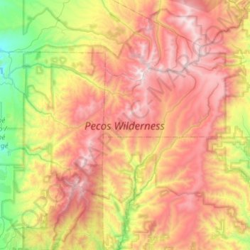
Name: Pecos Wilderness topographic map, elevation, terrain.
Location: Pecos Wilderness, Mora County, New Mexico, United States (35.70668 -105.87497 36.07161 -105.39141)
Average elevation: 9,472 ft
Minimum elevation: 6,286 ft
Maximum elevation: 13,045 ft
Mora County trails, hiking, mountain biking, running and outdoor activities
Other topographic maps
Click on a map to view its topography, its elevation and its terrain.
Mora
United States > New Mexico > Mora County
Mora or Santa Gertrudis de lo de Mora is a census-designated place in, and the county seat of, Mora County, New Mexico. It is located about halfway between Las Vegas and Taos on Highway 518, at an altitude of 7,180 feet. The Republic of Texas performed a semi-official raid on Mora in 1843. Two short battles of…
Average elevation: 7,536 ft