Geolocate

Beaverhead-Deerlodge National Forest topographic map

Interactive map

Click on the map to display elevation.

About this map

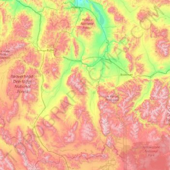
Name: Beaverhead-Deerlodge National Forest topographic map, elevation, terrain.

Location: Beaverhead-Deerlodge National Forest, Gravelly Range Road, Madison County, Montana, USA (44.35792 -113.93810 46.68762 -111.39213)

Average elevation: 6,575 ft

Minimum elevation: 3,645 ft

Maximum elevation: 11,112 ft

Other topographic maps

Click on a map to view its topography, its elevation and its terrain.

Madison River

USA > Montana

Average elevation: 4,131 ft

Red Butte

USA > Montana

Average elevation: 3,297 ft

Mannix

USA > Montana > Mannix

Average elevation: 4,888 ft

Capital Hill

USA > Montana > Boulder

Average elevation: 4,928 ft