Geolocate

Fremont County topographic maps

Click on a map to view its topography, its elevation and its terrain.
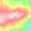
Sweetwater Station

United States > Wyoming > Fremont County

Average elevation: 6,631 ft

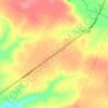
Mount Popo Agie

United States > Wyoming > Fremont County

Average elevation: 9,344 ft

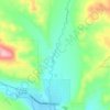
Whiskey Mountain

United States > Wyoming > Fremont County

Average elevation: 10,423 ft

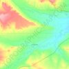
South Pass

United States > Wyoming > Fremont County

South Pass (elevation 7,412 ft (2,259 m) and 7,550 ft (2,300 m)) is a route across the Continental Divide, in the Rocky Mountains in southwestern Wyoming. It lies in a broad high region, 35 miles (56 km) wide, between the nearly 14,000 ft (4,300 m) Wind River Range to the north and the over 8,500 ft (2,600 m)…

Average elevation: 7,530 ft
Dinwoody Lake

United States > Wyoming > Fremont County

Average elevation: 6,804 ft

Horse Creek

United States > Wyoming > Fremont County > Dubois

Average elevation: 7,119 ft

Arapahoe

United States > Wyoming > Fremont County

Average elevation: 5,102 ft

Fort Washakie

United States > Wyoming > Fremont County

Average elevation: 5,715 ft

Pavillion

United States > Wyoming > Fremont County

Average elevation: 5,463 ft

Boysen State Park

United States > Wyoming > Fremont County > Shoshoni

Average elevation: 5,095 ft

About this place

 •

Gear up for your next adventure:

📦Dry Bags Set - Waterproof storage for electronics and clothes
🪑Ultralight Camp Chairs - Portable seating for resting after a long day of mapping
🎒Waterproof Dry Bags - Keep your electronics and maps dry inside your pack
☀️Outdoor Sunscreen - High protection sunscreen for outdoor activities
💧Water Filtration Bottles - Safely drink from streams and lakes while exploring

As an Amazon Associate, this site earns from qualifying purchases at no extra cost to you.