
Kelibia topographic map
Interactive map
Click on the map to display elevation.
About this map
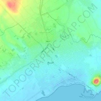
Name: Kelibia topographic map, elevation, terrain.
Location: Kelibia, قليبية الغربية, معتمدية قليبية, Nabeul, Tunisia (36.83223 11.07358 36.86801 11.12233)
Average elevation: 56 ft
Minimum elevation: -13 ft
Maximum elevation: 236 ft
Other topographic maps
Click on a map to view its topography, its elevation and its terrain.
Kelibia
Tunisia > Nabeul > قليبية الغربية
Kelibia, قليبية الغربية, معتمدية قليبية, Nabeul, 8090, Tunisia
Average elevation: 59 ft