
Curry Village topographic map
Interactive map
Click on the map to display elevation.
Curry Village
The resort is 1 mile (1.6 km) southeast of Yosemite Village, at an elevation of 4,003 feet (1,220 m), and occupies a central position in the Yosemite Valley. It lies on a talus cone of debris from old rockfalls.
About this map
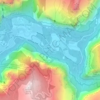
Name: Curry Village topographic map, elevation, terrain.
Average elevation: 5,318 ft
Minimum elevation: 3,947 ft
Maximum elevation: 8,133 ft
Mariposa County trails, hiking, mountain biking, running and outdoor activities
Other topographic maps
Click on a map to view its topography, its elevation and its terrain.
Yosemite Valley
United States > California > Mariposa County > Yosemite Village
Average elevation: 6,614 ft
Yosemite Valley
United States > California > Mariposa County > Yosemite Village
Average elevation: 6,614 ft