
Joplin topographic map
Interactive map
Click on the map to display elevation.
About this map
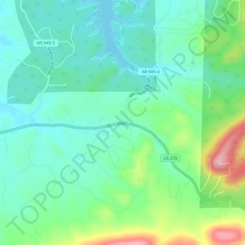
Name: Joplin topographic map, elevation, terrain.
Location: Joplin, Montgomery County, Arkansas, United States (34.52231 -93.47269 34.56231 -93.43269)
Average elevation: 758 ft
Minimum elevation: 568 ft
Maximum elevation: 1,276 ft
Montgomery County trails, hiking, mountain biking, running and outdoor activities
Other topographic maps
Click on a map to view its topography, its elevation and its terrain.