
Nethers topographic map
Interactive map
Click on the map to display elevation.
About this map
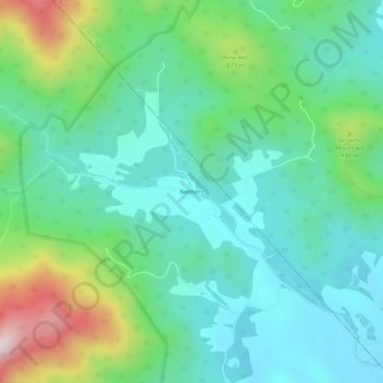
Name: Nethers topographic map, elevation, terrain.
Location: Nethers, Madison County, Virginia, 22719, United States (38.55035 -78.29819 38.59035 -78.25819)
Average elevation: 1,165 ft
Minimum elevation: 663 ft
Maximum elevation: 2,569 ft
Madison County trails, hiking, mountain biking, running and outdoor activities
Other topographic maps
Click on a map to view its topography, its elevation and its terrain.