
Rocky Mount topographic map
Interactive map
Click on the map to display elevation.
About this map
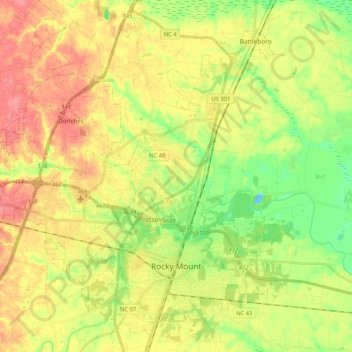
Name: Rocky Mount topographic map, elevation, terrain.
Location: Rocky Mount, Edgecombe County, North Carolina, United States (35.90156 -77.90394 36.06837 -77.73565)
Average elevation: 125 ft
Minimum elevation: 13 ft
Maximum elevation: 233 ft
Edgecombe County trails, hiking, mountain biking, running and outdoor activities
Other topographic maps
Click on a map to view its topography, its elevation and its terrain.
Clifton Ridge
United States > North Carolina > Edgecombe County > Tarboro > Clifton Ridge
Average elevation: 92 ft