
Wevelgem topographic map
Interactive map
Click on the map to display elevation.
About this map
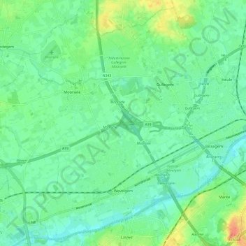
Name: Wevelgem topographic map, elevation, terrain.
Location: Wevelgem, Kortrijk, West Flanders, 8560, Belgium (50.79392 3.10243 50.86572 3.22292)
Average elevation: 66 ft
Minimum elevation: 20 ft
Maximum elevation: 167 ft
Other topographic maps
Click on a map to view its topography, its elevation and its terrain.