
Thank you for supporting this site ❤️
Make a donation
Make a donation
Gear up for your next adventure:
As an Amazon Associate, this site earns from qualifying purchases at no extra cost to you.
Chacapampa topographic map
Click on the map to display elevation.
Thank you for supporting this site ❤️
Make a donation
Make a donation
Gear up for your next adventure:
As an Amazon Associate, this site earns from qualifying purchases at no extra cost to you.
About this map
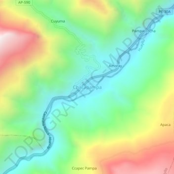
Name: Chacapampa topographic map, elevation, terrain.
Location: Chacapampa, Colcabamba, Aymaraes, Apurímac, Perú (-14.05872 -73.24756 -14.01872 -73.20756)
Average elevation: 9,062 ft
Minimum elevation: 7,552 ft
Maximum elevation: 11,732 ft
Thank you for supporting this site ❤️
Make a donation
Make a donation
Gear up for your next adventure:
As an Amazon Associate, this site earns from qualifying purchases at no extra cost to you.