Geolocate

Luna topographic map

Click on the map to display elevation.

About this map

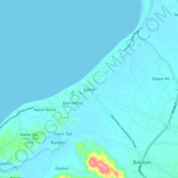
Name: Luna topographic map, elevation, terrain.

Location: Luna, La Union, Ilocos Region, 2518, Philippines (16.81360 120.33768 16.89360 120.41768)

Average elevation: 26 ft

Minimum elevation: 0 ft

Maximum elevation: 423 ft

Other topographic maps

Click on a map to view its topography, its elevation and its terrain.

Sudipen

Philippines > La Union

Average elevation: 315 ft

Caba

Philippines > La Union

Average elevation: 200 ft

Santo Tomas

Philippines > La Union

Average elevation: 194 ft

Gear up for your next adventure:

🔌USB Car Charger - Car charger for on‑the‑go power needs
🪶Camp Gear Gift Set - Perfect gift bundle for outdoor fans
💧Water Filtration Bottles - Safely drink from streams and lakes while exploring
🥄Camping Utensil Set - Lightweight utensils for outdoor meals
🚪Portable Camp Chair - Foldable chair for comfort at camp

As an Amazon Associate, this site earns from qualifying purchases at no extra cost to you.