Geolocate

Sobrado topographic map

Click on the map to display elevation.

About this map

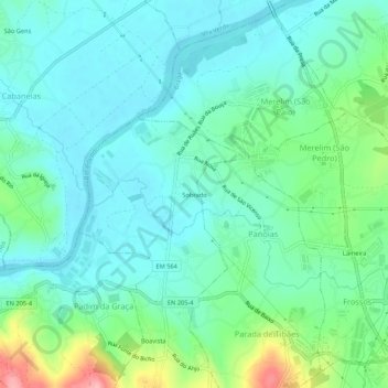
Name: Sobrado topographic map, elevation, terrain.

Location: Sobrado, Mire de Tibães, Braga, 4700-760, Portugal (41.55664 -8.49363 41.59664 -8.45363)

Average elevation: 157 ft

Minimum elevation: 52 ft

Maximum elevation: 499 ft

Gear up for your next adventure:

🪶Camp Gear Gift Set - Perfect gift bundle for outdoor fans
🧣Merino Neck Gaiters - Multi-functional headwear for wind and sun protection
🪶Trail Camera - Capture wildlife on your hikes
🎁Geography Themed Gifts - Unique gift ideas for map lovers and geography enthusiasts
🧤Hiking Gloves - Protective gloves for rugged trails

As an Amazon Associate, this site earns from qualifying purchases at no extra cost to you.