
Thank you for supporting this site ❤️
Make a donation
Make a donation
Gear up for your next adventure:
As an Amazon Associate, this site earns from qualifying purchases at no extra cost to you.
Rival topographic map
Click on the map to display elevation.
Thank you for supporting this site ❤️
Make a donation
Make a donation
Gear up for your next adventure:
As an Amazon Associate, this site earns from qualifying purchases at no extra cost to you.
About this map
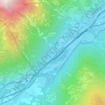
Name: Rival topographic map, elevation, terrain.
Location: Rival, Salbertrand, Turin, Piémont, 10056, Italie (45.03916 6.84254 45.07916 6.88254)
Average elevation: 4,734 ft
Minimum elevation: 3,278 ft
Maximum elevation: 9,131 ft
Thank you for supporting this site ❤️
Make a donation
Make a donation
Gear up for your next adventure:
As an Amazon Associate, this site earns from qualifying purchases at no extra cost to you.