
Thank you for supporting this site ❤️
Make a donation
Make a donation
Gear up for your next adventure:
As an Amazon Associate, this site earns from qualifying purchases at no extra cost to you.
Egastiaga topographic map
Click on the map to display elevation.
Thank you for supporting this site ❤️
Make a donation
Make a donation
Gear up for your next adventure:
As an Amazon Associate, this site earns from qualifying purchases at no extra cost to you.
About this map
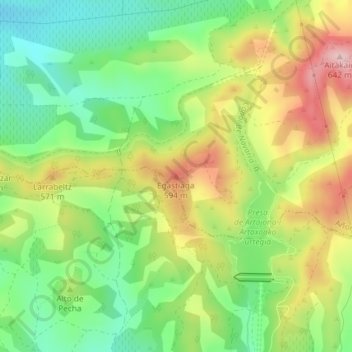
Name: Egastiaga topographic map, elevation, terrain.
Location: Egastiaga, Añorbe, Valdizarbe-Novenera, Navarra, 31140, España (42.62498 -1.74605 42.62508 -1.74595)
Average elevation: 1,654 ft
Minimum elevation: 1,342 ft
Maximum elevation: 2,070 ft
Thank you for supporting this site ❤️
Make a donation
Make a donation
Gear up for your next adventure:
As an Amazon Associate, this site earns from qualifying purchases at no extra cost to you.