Geolocate

Pipers Gap topographic map

Click on the map to display elevation.

About this map

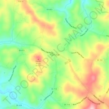
Name: Pipers Gap topographic map, elevation, terrain.

Location: Pipers Gap, Carroll County, Virginia, United States (36.62430 -80.86202 36.66430 -80.82202)

Average elevation: 2,753 ft

Minimum elevation: 2,477 ft

Maximum elevation: 3,104 ft

Carroll County trails, hiking, mountain biking, running and outdoor activities

Other topographic maps

Click on a map to view its topography, its elevation and its terrain.

Laurel Fork

United States > Virginia > Carroll County

Average elevation: 2,530 ft

Chestnut Creek

United States > Virginia > Carroll County > Galax

Average elevation: 2,484 ft

Laurel Fork

United States > Virginia > Carroll County

Average elevation: 2,575 ft

Laurel Fork

United States > Virginia > Carroll County

Average elevation: 2,638 ft

Gear up for your next adventure:

🧺Microfiber Travel Towels - Compact and fast-drying towels for trail use
📌Outdoor GPS Map App - Apps and devices for digital topographic navigation
🔭Compact Binoculars - HD vision for scouting terrain and identifying distant landmarks
🔥Plasma Lighters - Windproof lighters that work in any weather condition
🌄Hiking Binoculars - Compact binoculars for scenic views and trail spotting

As an Amazon Associate, this site earns from qualifying purchases at no extra cost to you.