
Make a donation
Gear up for your next adventure:
As an Amazon Associate, this site earns from qualifying purchases at no extra cost to you.
Nothberg topographic map
Click on the map to display elevation.
Make a donation
Gear up for your next adventure:
As an Amazon Associate, this site earns from qualifying purchases at no extra cost to you.
Nothberg
Existierende Stadtbezirke und Stadtteile 1 Altstadt / Klee Oepe / Südstadt / West | 2 Ost / Vöckelsberg | 3 Röthgen | 4 Röhe | 5 St. Jöris | 6 Kinzweiler | 7 Hehlrath | 8 Dürwiß | 9 Neu-Lohn / Fronhoven | 10 Weisweiler / Hücheln / Wilhelmshöhe | 11 Nothberg | 12 Bergrath / Bohl / Volkenrath | 13 Hastenrath / Scherpenseel | 14 Stich / Siedlung Jägerspfad | 15 Pumpe / Aue / Siedlung Waldschule
Make a donation
Gear up for your next adventure:
As an Amazon Associate, this site earns from qualifying purchases at no extra cost to you.
About this map
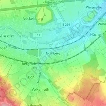
Name: Nothberg topographic map, elevation, terrain.
Average elevation: 512 ft
Minimum elevation: 387 ft
Maximum elevation: 794 ft
Make a donation
Gear up for your next adventure:
As an Amazon Associate, this site earns from qualifying purchases at no extra cost to you.
Other topographic maps
Click on a map to view its topography, its elevation and its terrain.
52249
Deutschland > Nordrhein-Westfalen > Städteregion Aachen > Eschweiler > Dürwiß
Average elevation: 528 ft
Blausteinsee
Deutschland > Nordrhein-Westfalen > Städteregion Aachen > Eschweiler > Fronhoven
Am 5. Oktober 1994 begann die Befüllung des Blausteinsees. Die Wasserfontäne befand sich etwa in Seemitte rund 500 m vom Ufer entfernt und spritzte mit etwa 210 Litern Wasser pro Sekunde 40 m in die Höhe. Jährlich flossen bis zu 6,7 Millionen Kubikmeter Wasser in den See, und für die Erstbefüllung waren…
Average elevation: 469 ft